- Permanently bonded between two sheets of tough, flexible, crystal clear plastic making them virtually indestructible
- It also gives the map surface a dry or white finish allowing you to update information at a stroke
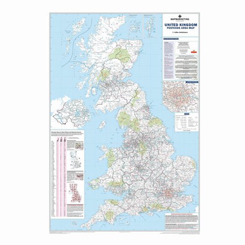
- Detailed 4-colour single sheet map of UK (GB and N Ireland) showing postcode area letters on a background map showing county boundaries and main roads
- WxH: 830x1200mm
- Scale - 12.5miles:1 inch
<
>
Map Marketing British Isles Postal Area Map BIPA
Product Code: NSI9000
Product Unit: Each

Non-Returnable Product
People who bought this also bought


Product Details
General Information
| Region | Great Britain & NI |
| Dimensions | 830x1200mm |
| Frame | Unframed |
| Manufacturer | Map Marketing |
| Warranty | 12 Months |
| Surface | Drywipe & Wetwipe |
Product Information
| Brand | Map Marketing |
| Type | Map |
Description
LAMINATED MAPS: Permanently bonded between two sheets of tough, flexible, crystal clear plastic making them virtually indestructible. It also gives the map surface a dry or white finish allowing you to update information at a stroke. Detailed 4-colour single sheet map of UK (GB and N Ireland) showing postcode area letters on a background map showing county boundaries and main roads. WxH: 830x1200mm. Scale - 12.5miles:1 inch.
Alternative Products
We are sorry but no alternatives are currently available.